
 On Friday I downloaded a new app for my android phone: Boston Bus Map. It’s a free app that uses the MassDOT xml feed to show current bus locations and give estimates for arrivals at a given stop.
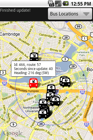
I have only just begun using the app, but so far I find it very cool & useful. I brought up the 77 route, which runs near my house, and got a google map with an overlay showing the location and direction of each bus on the route. Tapping on a bus shows a little pop-up window with the bus id, route name/number, exact heading, and number of seconds since the last update.
Like many people in the Boston area, I often have two or three ways to get from point A to point B, and knowing exactly how long it will be until the next bus will be a great help in deciding the best way to go. At some point I’m going to go sit at my nearby bus stop and try to get a feel for how accurate the data really is.
BostonBusMap has a…
web page
twitter account
developer blog